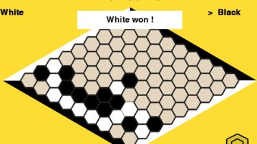
Recreation of HexGame in Pygame
Hex with Pygame Recreation of HexGame in Pygame. Whats is Hex ? Historical point of view Hex as been created in 1942 by a Danish mathematician named Piet Hein. The first commercialization of this game is in 1952. With time, some strategies to win have been seeking. Thus, techniques have been found to consistently win on a 7×7 and 9×9 Board. More recently, in 2019, Facebook succeeds in beating the best player of Hex on a 19×19 board. What Are […]
Read more