Build surface water network for MODFLOW’s SFR Package

Surface water network
Creates surface water network, which can be used to create MODFLOW’s SFR.
Python packages
Python 3.6+ is required.
Required
geopandas– process spatial data similar to pandaspyproj>=2.2– spatial projection supportrtree– spatial index support
Optional
flopy– read/write MODFLOW modelsnetCDF4– used to read TopNet files
Testing
Run pytest -v or python3 -m pytest -v
For faster multi-core pytest -v -n 2 (with pytest-xdist)
Examples
import geopandas
import pandas as pd
import swn
import swn.file
Read from Shapefile:
shp_srs = 'tests/data/DN2_Coastal_strahler1z_stream_vf.shp'
lines = geopandas.read_file(shp_srs)
lines.set_index('nzsegment', inplace=True, verify_integrity=True)  # optional
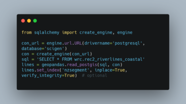
Or, read from PostGIS:
from sqlalchemy import create_engine, engine
con_url = engine.url.URL(drivername='postgresql', database='scigen')
con = create_engine(con_url)
sql = 'SELECT * FROM wrc.rec2_riverlines_coastal'
lines